1986 - Butterfield Green, Allen Road, Stoke Newington flickr.com/photos/9328765…
Back to themes
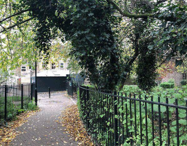
Butterfield Green
Green Space and Waterways
Posts specifically about Butterfield Green and its local setting.
175 (<1%) posts currently match this theme.
Note: Theme classification is AI-enabled and imperfect, so some posts here will be misclassified and some relevant posts may be missing.
Filter posts within this theme by keyword, date range, image presence, or sort order.
Show theme trend over time Hide theme trend
Theme trend
Matches over time
Showing all years in this theme.
Showing first 100 posts…
1989 - Butterfield Green from Spenser Grove, Stoke Newington
The Creation of Butterfield Green Stoke Newington locallocalhistory.co.uk/studies/butter…
1986 - Butterfield Green, Stoke Newington. Prince of Wales pub on the corner of Nevill Rd/Allen Rd is on the left.
RT @LauraGowing: @HistoryOfStokey more Butterfield Green history here locallocalhistory.co.uk/studies/butter…
1986 - Butterfield Green, Stoke Newington (Photo by Berris Conolly berrisconolly.com) https://t.co/FfNQ87RCjG
The Allen Arms pub on Allen Road next to Butterfield Green. Converted to flats following fire.
The Allen Arms pub on Allen Road near Butterfield Green. Converted to flats.
Mashup: Cowper Road, Stoke Newington looking north towards Allen Road. Butterfield Green Playground now on the right.
Butterfield Green in 1986 looking east. Allen Road on the left with the Prince of Wales pub visible at the corner of Allen Road/Nevill Road
@CaramelBear81 See here. Wordsworth Rd was the border so Butterfield Green is in the area where the detached South Hornsey section was. However, by the time Butterfield Green was created the area was no longer South Hornsey. Those SH sections were enclaves within SN parish.
Before Butterfield Green - Nevill Road near Allen Road with St Matthias Church in the background. Brighton Road is on the left. The shops on the left were converted to flats.
RT @LynRennick: @HistoryOfStokey @MsNewBrighton If U come across this pic, which is supposed 2B the 1st part of Butterfield Green, it isnt.…
A fascinating view from 9 Allen Road of a much-changed Cowper Road, with Matthias Road in the distance. Butterfield Green is now on the left. The street was built in the 1850s as part of the Albert Town development. They were pulled down in the early 80s. Photo by Roy Martin.
Houses in Milton Grove between Town Hall Approach and Allen Road awaiting demolition in the late 1970s ahead of the creation of Butterfield Green. (Source: facebook.com/groups/ILivedI…) https://t.co/K4MUgsa4rS
1982 - Demolition of houses in Cowper Road where Butterfield Green is now. (Photos kindly provided by Marc Caucutt)
33 Cowper Road in 1982 where Butterfield Green is now. Photo courtesy of Marc Caucutt.
@georgemaudsley No. Butterfield Green was developed in stages during the late 1970s-early 1980s.
33 Cowper Rd in 1980 where Butterfield Green is now. It was hit during a Zeppelin raid on 31.5.15. Fire caused great damage to the house. A three year old girl was suffocated and burnt to death and her 11 year old sister died of her burns several days later. Photo by Marc Caucutt
Cowper Road in the 1960s near no. 33 where Butterfield Green is now. Photo courtesy of Marc Caucutt.
A much-changed Wordsworth Road in the mid-1970s where Butterfield Green is now. (Source: Hackney Archives hackney.soutron.net/Portal/Default… hackney.soutron.net/Portal/Default… hackney.soutron.net/Portal/Default…) https://t.co/2cbz5qmnDA

Then & Now: Wordsworth Road, Stoke Newington in 1975. Butterfield Green was developed in stages during the late 70s-early 80s. (Archival photo: hackney.soutron.net/Portal/Default…) https://t.co/8hgJca2Uh0
1977 - Nos. 87-109 Spenser Grove, where Butterfield Green is now, looking towards Allen Road. Built as part of the Albert Town development in the 1850s. Butterfield Green was developed in stages during the late 70s-early 80s. (Source: hackney.soutron.net/Portal/Default…) https://t.co/xrKp7I…
1977 - Nos. 87-109 Spenser Grove, where Butterfield Green is now, looking towards Allen Road. Built as part of the Albert Town development in the 1850s. Butterfield Green was developed in stages during the late 70s-early 80s. (Source: hackney.soutron.net/Portal/Default…) https://t.co/xrKp7IjUTb
Then & Now: Spenser Grove in 1977 looking towards Allen Road. Built in the 1850s. Now Howitt Close and Butterfield Green. Butterfield Green was developed in stages in the late 70s-early 80s. (Archival photo: hackney.soutron.net/Portal/Default…) https://t.co/qvtK7G1C9s

Then & Now: Cowper Road where the entrance to Butterfield Green in Allen Road near Nevill Road is now. Butterfield Green was developed in stages during the late 70s-early 80s. (Archival photo: hackney.soutron.net/Portal/Default…) https://t.co/EgiW1nlCC8
Marc Caucutt’s memories from 1982 of living in the last occupied house in Cowper Road in a demolition area as part of the street was being cleared following a Compulsory Purchase Order to make way for Butterfield Green.
THREAD: Lesley Butler kindly shared with me family photos showing Spenser Road near Allen Road where she grew up in the late 1970s. Compulsory purchase orders were issued by the council for the 1850s houses in the area in the late 70s-early 80s to develop Butterfield Green.
Lesley Butler: “We weren’t told about Butterfield Green. We were told the demolition is because the houses were very old and not in a particularly good state. We had no bathroom - only a toilet. The council may have told our landlord the reason but i'm sure mum wasn't aware.”
In case you ever wondered what’s inside the Electricity Sub-Station in Wordsworth Road by Butterfield Green. Not much it seems. (@realnickperry)
Inside the electricity sub-station in Wordsworth Road by Butterfield Green x.com/realnickperry/…
@GregUllyart That’s 1973 and you can see some of the houses are boarded up. Butterfield Green by the way was also developed on the site of streets that were cleared following Compulsory Purchase Orders in the late 70s and early 80s.
The Allen Arms, 8 Allen Road next to Butterfield Green. Converted to flats.
A view of Cowper Road from 9 Allen Road with Matthias Road in the distance. This is now the entrance to Butterfield Green. The houses were pulled down in the late 70s and early 80s following Compulsory Purchase Order in order to develop Butterfield Green. Photo by Roy Martin.
A view of Allen Rd/Cowper Rd from 9 Allen Rd. This is now the entrance to Butterfield Green. The houses were pulled down in the late 70s and early 80s following Compulsory Purchase Order in order to develop Butterfield Green. Photo by Roy Martin.
@drewerydyke At the same time you had the clearing of Victorian streets where Shellgrove Road Estate is now and also the clearing o houses to make way for Butterfield Green.
@Britinfloridaus They were lived in at the time. Compulsory Purchase Order was issued to clear the site of the future Butterfield Green.
@Britinfloridaus I’m not disagreeing but in the context of city planning, a ‘slum’ as I’m aware was/is an official term and in the case of the streets where Butterfield Green is now I don’t know for a fact they were considered officially a ‘slum’ like in the 30s and another reas…
@Britinfloridaus I’m not disagreeing but in the context of city planning, a ‘slum’ as I’m aware was/is an official term and in the case of the streets where Butterfield Green is now I don’t know for a fact they were considered officially a ‘slum’ like in the 30s and another reason was given.
@Britinfloridaus I wonder now what the official reason given for the clearing of the houses where Butterfield Green is now. I know people that grew up there and may know.
Cowper Rd from Allen Rd with Matthias Rd in the distance. This is now the entrance to Butterfield Green in Allen Rd near Nevill Rd. Butterfield Green was developed in stages from the late 70s after Compulsory Purchase Orders were issued for the houses. Photo by Roy Martin.
@LynRennick I’m still curious how the council was able to justify clearing that many houses to create Butterfield Green.
@LynRennick How was creating Butterfield Green ‘being like Hackney’?
@LynRennick anything more specific about Butterfield Green? Did some residents campaign to have green space in that area for example?
@RobinJarossi There was also significant clearing of Victorian streets in the 70s and early 80s to create Butterfield Green, Yorkshire Grove Estate and Shellgrove Estate in south Stoke Newington. Clearing of older houses (big and small) took place in the 1930s to build social ho…
@RobinJarossi There was also significant clearing of Victorian streets in the 70s and early 80s to create Butterfield Green, Yorkshire Grove Estate and Shellgrove Estate in south Stoke Newington. Clearing of older houses (big and small) took place in the 1930s to build social housing.
@davidjmadden @highamnews This shows how many houses were lost to develop Butterfield Green x.com/HistoryOfStoke…

Then & Now: Cowper Road. The houses on the east side were cleared c. 1980 as part of the development of Butterfield Green.

Then & Now: Cowper Road. The houses on the east side were cleared c. 1980 as part of the development of Butterfield Green.

Then & Now: Milton Grove (formerly Milton Road). These houses were cleared c. 1980 as part of the development of Butterfield Green.

Then & Now: Wordsworth Road. Butterfield Green developed c.1980

Then & Now: Wordsworth Road. Butterfield Green developed c.1980

Then & Now: Wordsworth Road. Butterfield Green developed c.1980
Demolition of houses in Cowper Road in the early 80s following Compulsory Purchase Orders as part of the development of Butterfield Green. The houses were built in the 1850s as part of the Albert Town development in south Stoke Newington. Photos provided by Marc Caucutt.
The rear of Cowper Road from Wordsworth Road before demolition in 1982 where Butterfield Green Playarea is today. The Wordsworth scrap metal dealers at the end of no. 33, which was between the two empty houses. Photo provided by Marc Caucutt.
Then & Now: Butterfield Park Playground in Wordsworth Road. Houses in Cowper Rd are awaiting demolition. Compulsory Purchase Orders were issued for houses in the 70s to clear streets south of Allen Road for the creation of Butterfield Green.
Then & Now: Cowper Rd from Allen Rd. Built in the 1850s as part of the Albert Town development. The houses were sound and occupied when Compulsory Purchase Orders were issued in the late 70s to clear streets south of Allen Road for the creation of Butterfield Green.
The site of the future Butterfield Green in 1947 and 1971. There’s a common misconception it was developed on a large bomb site, when in fact bomb damage in the area was relatively limited and houses were cleared in the 60s for social housing and 70s to develop Butterfield Green
Then & Now: Nevill Rd connected to Wordsworth Rd in 1960. On the left is Cowper Rd which connected Allen Rd and Matthias Rd before the creation of Butterfield Green in the late 70s and early 80s.
1986 - Butterfield Green. Photo by Berris Conolly. Compulsory Purchase Orders were issued in the 70s for occupied houses and shops in Cowper Rd, Wordsworth Rd and Spenser Grove to develop a public green space. The park was developed in stages throughout the late 70s and 80s.
The Allen Arms pub in Allen Road next to the entrance to Butterfield Green opposite Nevill Road. Now residential.
@LAnderson_Frank What do you mean? The houses in Albert Town that were affected by WW2 bombing, housing redevelopment in the 1960s-70s and the development of Butterfield Green in the late 70s-early 80s.
Then & Now: Shops and houses in Wordsworth Road where Butterfield Green is today. Butterfield Green was developed in stages during the late 70s and early 80s.
Then & Now: Wordsworth Road in the 1970s. Butterfield Green was developed in stages throughout the late 70s-early 80s.
@joeb_EY No slum clearance in the area apart from a small courtyard named Leonard’s Place off Allen Road. Bomb damage was relatively minimal and it was 1960s-70s housing development and the development of Butterfield Green in the late 70s-early 80s that transformed the area.
Then & Now: Wordsworth Road. Butterfield Green was developed in the late 70s and early 80s. (Archival photo courtesy of Jan Purkiss)
Then & Now: Wordsworth Rd/Palatine Rd with Cowper Rd on the left in 1985. 300 houses were demolished in the late 70s and early 80s using Compulsory Purchase Orders in order to develop Butterfield Green over several stages. The vast majority of the houses were lived in at the time
1971 aerial view showing the original Victorian streets and many houses south of Allen Road that were pulled down for the development of Butterfield Green (yellow) and modern housing (blue).
Then & Now: Demolition of Victorian houses in Cowper Road in 1982 as part of the development of Butterfield Green. Houses also demolished in Wordsworth Rd, Spenser Grove, Shakspeare Walk and Milton Grove. Photo by Marc Caucutt.
Then & Now: Allen Road/Wordsworth Rd in 1985. Many houses in the streets south of Allen Rd were demolished in the late 70s-early 80s using Compulsory Purchase Orders to develop Butterfield Green over several stages. The vast majority of the houses were lived in at the time.
Then & Now: Cowper Rd from Allen Rd. Built in the 1850s as part of the Albert Town development. The houses were sound and occupied when Compulsory Purchase Orders were issued in the late 70s to clear streets south of Allen Road for the creation of Butterfield Green.
A view of Allen Rd/Cowper Rd from 9 Allen Rd. This is now the entrance to Butterfield Green. The houses were pulled down in the late 70s and early 80s following Compulsory Purchase Order in order to develop Butterfield Green. Photo by Roy Martin.
1986 - Butterfield Green and Palatine Road. Photo by Berris Conolly. Butterfield Green was developed in stages during the late 70s and early 80s on the site of close to 300 Victorian houses that were demolished using Compulsory Purchase Orders. Nearly all the houses were lived in
33 Cowper Road in 1982 where Butterfield Green playarea is now. It was hit during a German zeppelin raid on 31.5.15. Fire caused great damage to the house. 3 year old Elsie Leggett died in the fire and her 11 year old sister Elizabeth May died of her burns several days later.
The site of Butterfield Green in 1985. This view is looking north with Palatine Road on the right. Cowper Road houses on the left awaiting demolition.
Then & Now: Allen Road/Wordsworth Rd in 1985. Many houses in the streets south of Allen Rd were demolished in the late 70s-early 80s using Compulsory Purchase Orders to develop Butterfield Green over several stages. The vast majority of the houses were lived in at the time.
Then & Now: Cowper Rd from Allen Rd. Built in the 1850s as part of the Albert Town development. The houses were sound and occupied when Compulsory Purchase Orders were issued in the late 70s to clear streets south of Allen Road for the creation of Butterfield Green.
Houses in Milton Grove between Town Hall Approach and Allen Road awaiting demolition in the late 1970s ahead of the creation of Butterfield Green.
Then & Now: Shops and houses in Wordsworth Road where Butterfield Green is today. Butterfield Green was developed in stages during the late 70s and early 80s.
Then & Now: Wordsworth Road in the 1970s. The buildings were demolished as part of the development of Butterfield Green in the late 70s-early 80s.
Then & Now: Cowper Rd, built in the 1850s as part of the Albert Town development in Hornsey Detached in south Stoke Newington. It used to connect Allen Rd and Matthias Rd. The west side (left) redeveloped circa 1970 and the east side circa 1980 when Butterfield Green was created.
@LalehKhalili The council made a decision to create a new green space and that was the cost. @LynRennick who has lived in the area all her life and lived though the creation of Butterfield Green may be able to provide more details about the project.
The same area by 1989 after the creation of Butterfield Green earlier in the decade. x.com/HistoryOfStoke… https://t.co/nwzIgtBlK6
These kind of urban redevelopment projects were fairly common in Stoke Newington in the 1970s, as Victorian houses, often occupied and in decent conditions were demolished to build modern housing or open spaces: Yorkshire Grove Estate, Shellgrove Rd Estate, Butterfield Green. ht…
These kind of urban redevelopment projects were fairly common in Stoke Newington in the 1970s, as Victorian houses, often occupied and in decent conditions were demolished to build modern housing or open spaces: Yorkshire Grove Estate, Shellgrove Rd Estate, Butterfield Green. x.com/HistoryOfStoke…
Then & Now: The Allen Arms, 8 Allen Road next to Butterfield Green. Converted to residential property.
@DataMacas The development of Butterfield Green in the late 70s till the mid 80s resulted in the demolition of about 300 houses, most of which were occupied, so considerable loss of regular, local customers. Also the decline of local shopping in part due to increase in car owner…
@DataMacas The development of Butterfield Green in the late 70s till the mid 80s resulted in the demolition of about 300 houses, most of which were occupied, so considerable loss of regular, local customers.
Also the decline of local shopping in part due to increase in car ownership.
Then & Now: 54 Allen Road. Allen Road was a bustling shopping street with 50 shops. All but 4 shops were converted to flats. Decline in local shopping and loss of 300 houses to create Butterfield Green in the late 70s-early 80s likely contributed to the demise of Allen Rd.
It was a pleasure interviewing Marc Caucutt who grew up in Cowper Road and lived through the dramatic transformation of the area as 300 houses were pulled down to create Butterfield Green. Marc took a lot of photos of the demolition that took place around him. Coming soon!
The scrapyard in Wordsworth Road where Butterfield Green playarea is today as seen in 1982 during the demolition of the east side of Cowper Road. Prince George Road in the background. Photo taken by Marc Caucutt from the back garden of 33 Cowper Rd.
The scrapyard in Wordsworth Road where Butterfield Green playarea is today as seen in 1982 during the demolition of the east side of Cowper Road. Photo taken by Marc Caucutt from the back garden of 33 Cowper Rd.
The scrapyard in Wordsworth Road where Butterfield Green playarea is today. Photo taken by Marc Caucutt from the back garden of 33 Cowper Rd. The area was redeveloped in the late 70s-80s as many houses were pulled down to create Butterfield Green.
Then & Now: East side of Cowper Road. It was demolished in the late 70s and early 80s as part of the development of Butterfield Green, which also resulted in the creation of Bennett Road; a very short stretch that connected Cowper Rd and Wordsworth Rd.
Then & Now: Wordsworth Terrace (1-7, 8-14 Wordsworth Road) where Butterfield Green Playground is today. Built c. 1850. Demolished c. 1980 along with close to 300 houses in the nearby streets to make way for a new public park.
'The Last House Standing - Marc Caucutt's account of the demolition of Cowper Road as part of the development of Butterfield Green' I'm pleased to share my 15min interview with Marc Caucutt about the development of Butterfield Green. Very insightful.
A view of Milton Grove across the newly created Butterfield Green in 1982. Around 120 Victorian houses and shops in Wordsworth Rd, Cowper Rd, Spenser Grove, Shakspeare Walk, Milton Grove and Allen Road were demolished circa 1980 to make way for a new local park.
@LAnderson_Frank Not yet but I’m keen to find out one day and dig into this when I get a chance. My assumption is it was Hackney Council that was behind the development of Butterfield Green. Any idea @realnickperry?
A view of Spenser Grove where Butterfield Green is today, across the Shakespeare Walk Adventure Playground, which at this stage was still just a large pit as the playground was being developed. Courtesy of Christoph Dit Loup Lutard.
Document about the extension of the Shakespeare Walk Adventure Playground. Interesting to see that at this point in time, Butterfield Green was referred to as Cowper Road Park. Courtesy of Christoph Dit Loup Lutard.
Then & Now: Shakspeare Walk in the 1970s before the development of Butterfield Green
Butterfield Green looking east to Palatine Road in 1986 following the clearance of 120 Victorian houses and shops in the late 70s and early 80s to develop a new local park. Photo by Berris Conolly.
Newly developed Butterfield Green in 1989. Palatine Rd on the left and Wordsworth Rd Substation on the right. Butterfield Green was developed on the site of of 120 Victorian houses that were demolished in the late 70s and early 80s to make way for a new local park.
Then & Now: Allen Road/Spenser Grove. There used to be 50 shops in Allen Road. Today there are 4. Spenser Grove used to connect Allen Road and Matthias Road. One of several streets that changed dramatically when Butterfield Green was created in the late 70s and early 80s.
Then & Now: Butterfield Green in the early 1980s. It was developed on the site of 120 Victorian houses that were pulled down in the late 70s and early 80s using Compulsory Purchase Orders to make way for a new local park.